
Review · USA HELICOPTER TOURS
Ultimate Small Plane Aerial Tour to See Badlands National Park
The Badlands from the air make far more sense than they do from a road. From a small plane, the ridges, folds, valleys, and colored hills spread out in one sweeping view. You can see how the park fits together, not just how one overlook looks from the ground. I like the generous flight time and the private format, which gives your group a quieter, more personal outing.
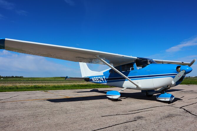
I also like the practical touches: Ana, the pilot and guide, explains the area while flying, and each guest receives a souvenir Polaroid plus a free branded T-shirt. The main consideration is weather. This is an outdoor flight over open country, so poor conditions can force a date change or cancellation. The plane is small, too, which is part of the charm but may not suit anyone uneasy with small-aircraft travel.
Key points to know before booking
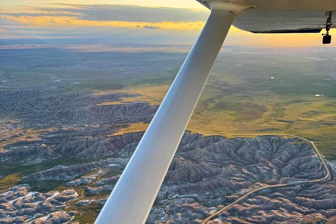
- About 65 minutes in the air: The longer flight gives you time to see the park’s major ridges, valleys, and remote areas rather than only one section.
- Private flight from Wall: Only your group participates, and the trip begins and ends at Wall Municipal Airport.
- Ana is both pilot and guide: She provides flight commentary and helps first-time small-plane passengers feel at ease.
- A photographer-friendly route: You may see Yellow Mounds, White River Valley, Toadstool Rock, Sheep Mountain Table, and more from above.
- Useful extras are included: You receive a souvenir Polaroid and a free branded T-shirt, with photo chances in the air and on the ground.
- Plan around the weather: You can cancel for a full refund up to 24 hours ahead, but poor weather may affect the departure.
Why an aerial view changes the Badlands
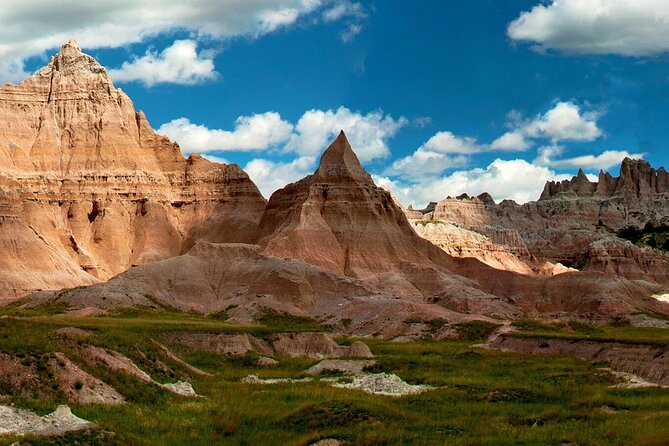
Badlands National Park is famous for sharp formations and striped hills, but the ground view can hide the park’s full shape. A trail or roadside pullout gives you one angle. The plane gives you the pattern: long ridges, broad basins, isolated tables, and open prairie running toward the horizon.
That wider view is the real reason to book this outing. You are not simply looking down at a few rock formations. You are seeing how the park stretches from the Wall area toward Interior, the White River Valley, and the more remote country around Sage Creek.
I especially like the way the flight combines scenery with orientation. Places that may seem separate from the road become part of one connected area from the air. If you are visiting Badlands National Park for the first time, this can help you understand where you have been and what you are seeing on the ground.
The flight lasts about one hour and five minutes. That is a meaningful amount of time for a small-plane tour. A shorter ride might give you a quick thrill and a few photographs, while this route allows more room for changing views, wildlife spotting, and conversation with the pilot.
More National Park Flights in the USA:
- ATV Tour of Lake Mead National Park with Optional Grand Canyon Helicopter Ride
★ 5.0 · 102 reviews - 55 Mile – Helicopter Tour Around Zion National Park
★ 4.5 · 73 reviews - Denali National Park: Helicopter Flight with Glacier Landing
★ 5.0 · 64 reviews
Starting at Wall Municipal Airport
You meet at Wall Municipal Airport in Wall, South Dakota. The airport is a practical launch point for the western side of Badlands National Park and keeps the experience focused on the flight rather than a long transfer from another town.
This is a private activity, so only your group participates. The advertised price is $359 per group, listed for up to one person. That makes the cost easiest to understand as a special solo outing rather than a low-cost group excursion. If you are alone and want a personal flight with plenty of attention from the pilot, the price may feel reasonable. If you are comparing it with a standard sightseeing tour, it is clearly a premium experience.
The short airport routine also helps. The operation is run by Fly Badlands, and Ana serves as pilot and guide. One account describes a quick turnaround from arrival to paperwork and takeoff, but you should still allow time for the normal preflight process and any weather checks.
The plane is a small aircraft, including the Cessna referred to as Betty. That gives the outing an old-fashioned, personal aviation feel. It also means you should expect a more intimate cabin than you would find on a large sightseeing aircraft. Noise-dampening headsets are provided for comfort and communication.
The western gateway and Wall area
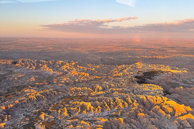
After takeoff, the route may include Wall and the surrounding country near the park’s western gateway. Wall is best known as the access point for visitors coming from the Black Hills and Interstate 90, while Interior serves as another gateway farther east.
Seeing this area from above gives you a useful sense of scale. The developed roads and town facilities quickly give way to open prairie and broken formations. From the plane, you can also see how the park sits within a much larger area of grassland and working country.
Minute Man National Historic Site may also appear along the route. This site commemorates the 1972 American Indian Movement occupation of Wounded Knee, an important and painful chapter in modern American history. The aerial view will not replace a visit on the ground, but it gives you another point of reference as you move through the region.
This portion of the flight is likely to feel less dramatic than the most colorful formations, but it helps place the park in context. I would pay attention here to the change from town and highway to open country. The transition happens quickly.
Yellow Mounds, Burns Basin, and the White River Valley
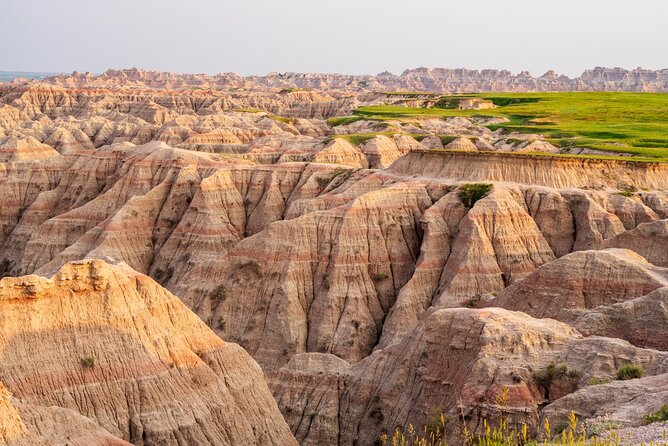
The Yellow Mounds are among the most visually unusual parts of the park. Their warm yellow tones come from ancient soils exposed by erosion, and the color can look striking from above. Aerial viewing helps because you can see the yellow bands as part of a larger sweep rather than as one roadside feature.
Burns Basin offers another change in texture and scale. The Badlands are not one continuous wall of cliffs. They include basins, shelves, ravines, and isolated formations. From the plane, you can watch those shapes overlap and recede, which is difficult to grasp from a single overlook.
The White River Valley broadens the view again. It provides a strong contrast with the broken ridges and narrow formations. You may find this part especially useful for photographs because it gives you both close geological detail and distant open views in the same frame.
The exact appearance depends on light and weather. On a clear day, you should have strong definition in the folds and valleys. In softer light, the colors may look gentler but the shadows can bring out the relief. The sunset option is worth considering if the schedule allows it. Ana has described sunset flights as especially rewarding for color, but late-day conditions can also reduce visibility if weather changes.
A few more flights around the USA worth comparing
- New York City: Manhattan Helicopter Tour
★ 4.7 · 7,076 reviews - NYC: Manhattan Sightseeing Helicopter Tour
★ 4.8 · 5,826 reviews - Las Vegas Helicopter Night Strip Flight Tour with Optional Dinner
★ 4.5 · 5,693 reviews - Grand Canyon Village: Helicopter Tour & Hummer Tour Options
★ 4.7 · 2,586 reviews
Saddle Pass, Bigfoot Pass, and the central formations
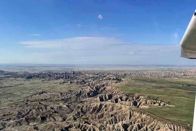
Saddle Pass and Bigfoot Pass show how water and erosion cut through the park. From the ground, these areas are associated with hiking routes and steep changes in elevation. From above, you can see the passes as breaks in the larger wall of formations.
This is where the flight becomes more than a photo ride. You get a sense of the routes that people use on foot and the difficult terrain surrounding them. A trail that seems like a short line on a park map can look much more demanding from the air.
The small aircraft is useful here because it can give you broad views while still keeping the formations visually close. You are not looking at the park from a distant commercial plane. At the same time, the plane’s windows and reflections can affect photographs, so listen to the pilot’s advice about when to shoot.
The tour includes photo opportunities both in the air and on the ground. The ground portion may be brief, but it gives you a chance to take a photograph around the aircraft and receive the souvenir Polaroid. The instant print is a simple touch, yet it is more personal than leaving with only phone images.
Interior, Toadstool Rock, and Sheep Mountain Table
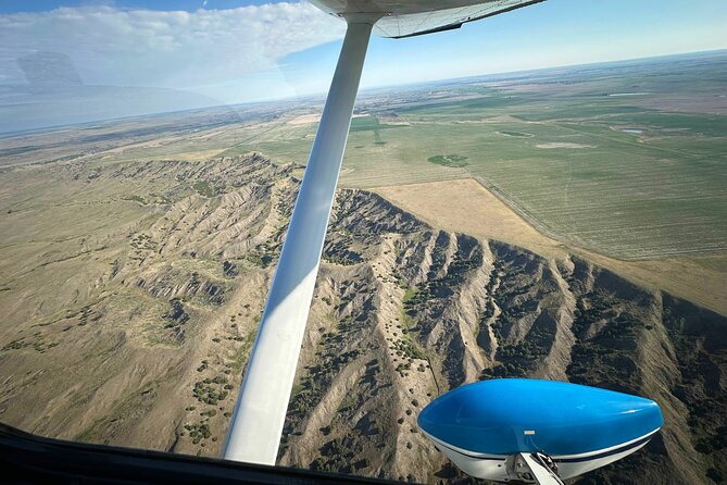
Interior is one of the principal communities near Badlands National Park. Seeing it from the air helps mark the eastern side of the route and shows how small settlements connect to the surrounding prairie.
Toadstool Rock is another possible sight. Its unusual shape makes it easy to appreciate from above, where you can see the isolated formation in relation to the surrounding ground. From a road-level viewpoint, you may focus only on the rock itself. From the plane, the setting becomes part of the story.
Sheep Mountain Table brings a larger, more distant form into view. A table is a high, relatively flat area surrounded by lower ground, and this kind of feature helps break up the sharp pinnacles and narrow ridges associated with the park. The contrast is valuable: the flight is not just a parade of pointed rocks.
I would keep your camera ready throughout this section. The route includes many named sights, but the spaces between them can be just as interesting. A bend in a ridge or a sudden change from pale rock to green prairie may make the best image of the hour.
The Pig Dig and Quinn Road Prairie Dog Town
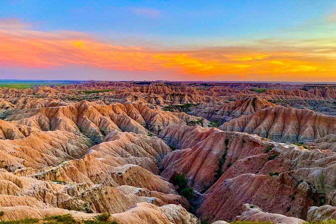
The Pig Dig is an archaeological site connected with ancient mammals found in the Badlands. From the air, you will not get the close detail that comes from a museum or interpretive display, but the site adds a layer of natural history to the flight.
Quinn Road Prairie Dog Town offers a very different sight. Prairie dog colonies can be hard to appreciate from a moving vehicle, yet the aerial angle may help you see the settlement pattern across the open ground. You should not expect to identify individual animals from the plane, but the colony itself may be visible depending on conditions.
These stops add variety to the route. The tour is not limited to dramatic cliffs. You may see evidence of ancient animals, living wildlife, prairie communities, and human history in the same general area. For children, those changes can make the flight more engaging than a nonstop sweep of rock formations.
Wildlife sightings are never guaranteed. The longer flight improves your chances because you spend more time over different kinds of country, but you should book this for the views first and treat animals as a bonus.
Sage Creek Wilderness and the Gunnery Range
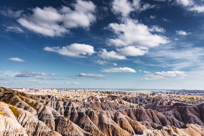
Sage Creek Wilderness is among the quieter and more remote parts of Badlands National Park. From the plane, you can see a less developed side of the area, with open prairie and rough formations stretching without the same roadside presence found near the main loop.
This is one of the places where the aerial tour earns its price. Reaching every remote corner on foot or by road would take much longer, while the flight gives you a broad look in a single outing. You will not replace a hike, but you will see how much country lies beyond the easy overlooks.
The Badlands Gunnery Range may also be included in the view. Its presence is a reminder that this region contains active-use areas as well as national park scenery. Your pilot handles the route and provides the relevant guidance, so you should follow instructions about photography and flight conditions.
The route list is best understood as a collection of possible sights, not a promise that each feature will receive the same amount of time. Flight paths can change with weather, visibility, and operating needs. That flexibility is normal for a small-aircraft experience.
What Ana adds to the flight
Ana is the owner, operator, pilot, and guide for Fly Badlands. Her role matters because the flight is not a silent sightseeing loop. She explains the Badlands and the surrounding area while also managing the aircraft.
Her calm approach is particularly useful if you have never flown in a small plane. One first-time passenger described feeling comfortable from takeoff through landing because Ana explained what was happening and remained friendly throughout the flight. That kind of steady communication can make a big difference when the cabin feels unfamiliar.
Ana also has a personal connection to the operation. Her enthusiasm for aviation and the Badlands comes through in the way she works, and the experience feels like a local business built around two strong interests rather than a large, anonymous tour machine.
The flight may be especially good for families, photographers, and anyone who likes asking questions. Children have reportedly wanted to return, and the private format means your group has more room to engage with the guide than it would on a large shared excursion.
Price, comfort, and small extras
At $359 per group up to one person, this is not a bargain attraction. It is a specialized flight, and the value depends on how much you want an aerial view and how difficult it would be for you to see the remote parts of the park by other means.
I think the price makes the most sense for a special occasion, a solo visitor with a strong interest in aviation or photography, or someone who has already seen the park from the road and wants a new perspective. The private arrangement and roughly 65-minute flight support the higher cost.
You receive a souvenir Polaroid, a free branded T-shirt, noise-dampening headsets, and photo opportunities on the ground and in the air. Snacks and drinks are available for purchase, but they are not included, so plan accordingly if you need refreshments around the flight.
Tips are optional. Mobile tickets are accepted, and the tour is offered in English. Most people can participate, but anyone uncertain about small-aircraft flying should consider the cabin size and speak with the operator before booking.
Weather, timing, and cancellation
Good weather is required. If Fly Badlands cancels because of poor conditions, you can choose another date or receive a full refund. That policy is helpful, but you should avoid scheduling the flight as your only fixed activity on a tightly packed Badlands day.
You can cancel for a full refund up to 24 hours before the scheduled start. Changes or cancellations made less than 24 hours ahead are not accepted for a refund. Confirmation normally arrives when you book, although reservations made within 12 hours of departure are confirmed as soon as possible, subject to availability.
The experience returns to Wall Municipal Airport, so you do not need to arrange a separate ride from another endpoint. Build some flexibility into your day, especially if you are also planning a long drive through the park.
Who should book this Badlands flight
I would choose this tour if you want to understand the park’s full shape, take photographs from a rare angle, or enjoy a personal flight with a local pilot. It is also a good fit if you have limited time but still want to see remote parts of the park.
You may want to skip it if you strongly dislike small aircraft, need a guaranteed departure in uncertain weather, or are looking for the cheapest way to see the Badlands. Aerial sightseeing cannot replace walking among the formations, feeling the wind on a trail, or stopping at every roadside overlook.
Should you book it?
Book the Ultimate Small Plane Aerial Tour if the idea of seeing Yellow Mounds, Sage Creek Wilderness, Sheep Mountain Table, and the White River Valley in one flight appeals to you. The long route, private setting, and Ana’s calm guiding make it more personal than a quick scenic ride.
I would book it early, especially if you want a sunset departure or have limited time in Wall. Keep your schedule flexible for weather, and treat the free T-shirt and Polaroid as welcome extras rather than the reason to go. The real value is the rare chance to see the Badlands as one enormous, connected place.
FAQ
Where does the aerial tour begin and end?
The tour begins at Wall Municipal Airport in Wall, South Dakota, and ends back at the same meeting point.
How long does the flight last?
The experience lasts approximately 1 hour and 5 minutes.
Is the tour private?
Yes. Only your group participates in this private activity.
What sights might I see from the plane?
Possible sights include Minute Man National Historic Site, Yellow Mounds, Burns Basin, White River Valley, Saddle Pass, Bigfoot Pass, Interior, Toadstool Rock, Sheep Mountain Table, The Pig Dig, Quinn Road Prairie Dog Town, Sage Creek Wilderness, and the Badlands Gunnery Range.
What is included with the tour?
The tour includes a souvenir Polaroid, noise-dampening headsets, photo opportunities on the ground and in the air, and a free branded T-shirt for each guest.
What happens if bad weather cancels the flight?
If poor weather causes cancellation, you will be offered a different date or a full refund. You can also cancel up to 24 hours before the start time for a full refund.
Newly added flights around the USA
- Zion National Park, Canaan Cliffs: Extended Helicopter Tour★ 4.5 · 4 reviews
- Zion National Park and Canaan Cliffs: Helicopter Tour★ 4.7 · 22 reviews
- West Maui and Molokai Special 45-Minute Helicopter Tour★ 5.0 · 9 reviews
- Waikoloa: Big Island Spectacular Helicopter Tour★ 4.5 · 5 reviews
- Oahu: Waikiki 20-Minute Doors On / Doors Off Helicopter Tour★ 4.9 · 32 reviews
- Las Vegas: Valley of Fire Helicopter with Scenic Landing★ 5.0 · 2 reviews
- Greater Yellowstone Trifecta Aerial Tour | 1-Hour Scenic Flight★ 5.0 · 6 reviews
- Couple’s Private Hudson Valley Fall Foliage Helicopter Tour from Westchester★ 4.5 · 3 reviews
USA Helicopter Tours, compared.



Las Vegas Helicopter Night Strip Flight Tour with Optional Dinner
Read our review →
Grand Canyon Village: Helicopter Tour & Hummer Tour Options
Read our review →
Grand Canyon Deluxe Helicopter Tour with Landing from Las Vegas
Read our review →
45-minute Helicopter Flight Over the Grand Canyon from Tusayan, Arizona
Read our review →
Kauai: Hughes 500 4-Passenger Doors-Off Helicopters
Read our review →Browse the lists this tour appears in