
Review · OAHU HELICOPTER TOURS
Complete Island Oahu Helicopter Tour
Oahu comes into focus from the air. In about 65 minutes, this small-group helicopter flight sweeps from Pearl Harbor to Waikiki, Diamond Head, Hanauma Bay, the windward beaches, the North Shore, and the dry west coast. You get the island’s big picture in one clean loop, including places you cannot reach by road.
I like the six-person limit, which keeps the cabin more personal and gives you a better chance to see out. I also like the two-way headsets, since your pilot can point out what you are seeing instead of leaving you to guess at the coastline below.
The main drawback is the price: $522.50 per person is a serious splurge for just over an hour. Weather can also force a delay or rescheduling, and late arrivals may lose their fare, so this takes more planning than a casual sightseeing stop.
Key points to know before booking
- The whole island fits into one flight: You see Pearl Harbor, Honolulu, the windward coast, North Shore, and West Oahu without spending a full day driving.
- The aircraft holds no more than six people: That makes this feel more focused than a large sightseeing flight.
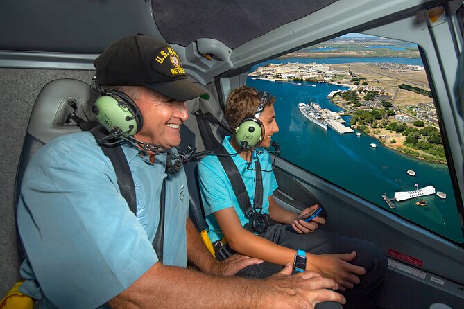
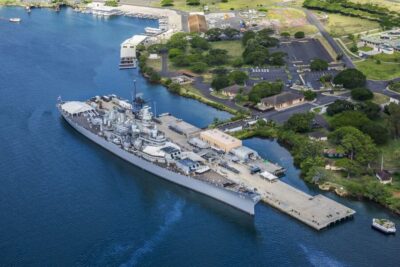
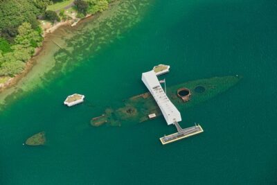
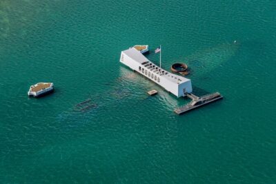
- Pearl Harbor looks different from above: The USS Arizona Memorial and the wider memorial grounds become part of the island’s larger story.
- A pilot-guide narrates the route: Pilots are also State of Hawaiʻi certified tour guides, with two-way microphones for questions.
- Your seat and clothing matter: Dark colors reduce window reflections, while hats, bags, large cameras, and extending selfie sticks are not allowed aboard.
- Weather controls the schedule: Check in 45 minutes early, and keep your plans flexible enough to handle a weather change.
Seeing Oahu as one connected island
This is not simply a flight over one scenic corner. It is a fast aerial tour of Oahu’s main regions, and that scale is the chief reason to consider it. From the ground, you may spend a morning reaching the North Shore, another visiting Pearl Harbor, and a third exploring Kailua. From the helicopter, those places connect in one sweeping view.
I find that especially useful early in an Oahu stay. The island’s ridges, bays, volcanic cones, and towns make more sense once you see how they fit together. You can also use the flight to decide which areas deserve more time on foot or by car later.
The flight lasts about one hour and five minutes. That is long enough for a broad circuit, but not so long that the ride becomes tiring for most people. The pilot narrates through Bose aviation-grade noise-canceling headsets, and the microphones allow two-way communication. You are not left with only engine noise and a view through the glass.
The small cabin has a practical benefit beyond comfort. With a maximum of six people, you have fewer heads in front of you and a more direct connection with the pilot. Still, seating position can affect your view, so do not assume every seat offers the same photo angle. One particularly useful piece of advice is to keep your phone battery full. You will have many short chances to photograph beaches, ridges, and landmarks as the helicopter moves along.
A few more flights around Oahu worth comparing
- Oahu: Magnum PI Hughes 500 4-Passenger Doors-Off Helicopters
★ 5.0 · 1,372 reviews - From Honolulu: Oahu 60min Helicopter Tour with Doors Off/On
★ 4.9 · 410 reviews - Oahu: Helicopter Tour with Doors On or Off
★ 4.9 · 221 reviews
Pearl Harbor from the air
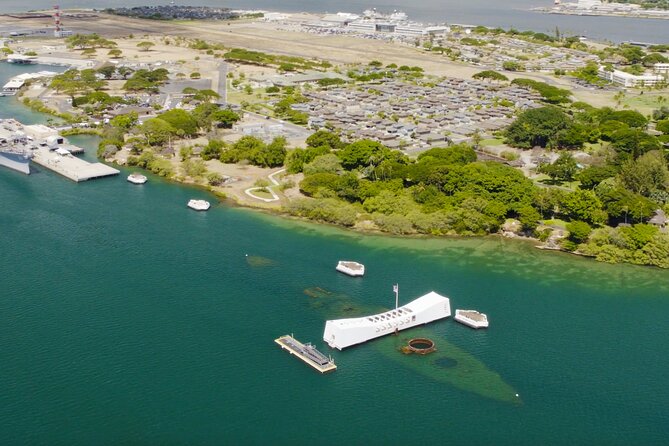
The route includes Pearl Harbor and the USS Arizona Memorial, the resting place of 1,102 of the 1,177 sailors and Marines killed aboard the ship during the December 7, 1941 attack. From above, the memorial is not an isolated sight. You see it within the broad harbor and the military setting around it.
That wider view adds context, but it does not replace a visit at ground level. The Pearl Harbor National Memorial includes nine historic sites connected with different parts of the war in the Pacific. If Pearl Harbor is important to you, I would treat the helicopter view as a preview, not your only visit.
Aerial sightseeing can also make the memorial feel more solemn than spectacular. The aircraft gives you a sense of location and scale, while the memorial itself carries the personal weight of the event. Your pilot’s narration helps connect the view to the place below.
Honolulu, Waikiki, and Diamond Head
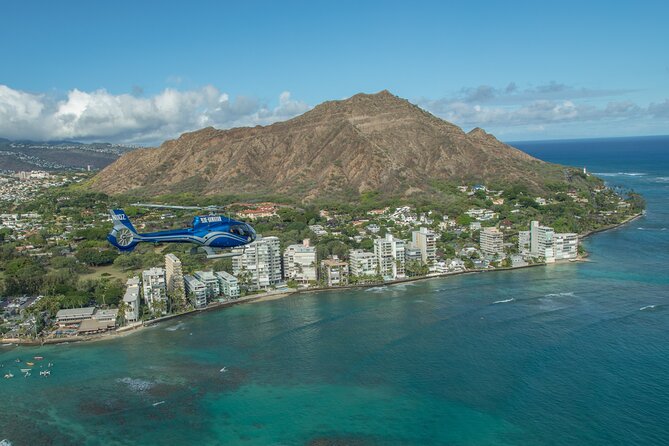
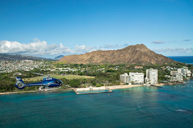
The helicopter then brings the urban side of Oahu into the picture. Waikiki’s line of high-rise hotels stretches along its famous surf beach, making it easy to spot from above. This view explains how concentrated Honolulu’s visitor district is, with dense buildings pressed against the coast and mountains rising behind the city.
Diamond Head, or Lēʻahi, is one of the clearest landmarks on the island. The volcanic cone sits at the edge of Honolulu and looks familiar from postcards, but the aerial angle shows its shape and position in relation to Waikiki. If you have walked near Diamond Head, the flight gives you a new sense of how sharply the cone rises from the city.
The trade-off is that aerial views are brief. You do not stop over any one landmark, and you will need to listen while taking photos. I recommend choosing a few must-see shots instead of trying to document every second.
Hanauma Bay and the windward coast
Hanauma Bay formed inside a volcanic cone and is now a marine preserve known for reef and sea life. From above, the curved bay and its protected shape are the main attraction. The flight lets you see why the water here is sheltered and why the area became one of Oahu’s best-known snorkeling sites.
Lanikai Beach offers a different kind of coastal view. Its clear water and pale sand create one of the island’s most recognizable beach scenes. The nearby Mokulua Islands, about a mile offshore, are small sanctuaries for Native birds, and their position gives the coast an unmistakable outline.
Kailua is the main town on Oahu’s windward, or eastern, side. From the air, its beaches and clear water sit between town and mountain country. You will not have time to explore Kailua during the flight, but the view can help you choose it for a later beach day.
These coastal stops are where weather and light matter most. On a clear day, the water can show sharp changes in color around reefs and shallow areas. In poor visibility, the flight may be rescheduled, which is frustrating if your plans are tight but sensible for both safety and sightseeing.
Same view, a different flight:
- Private Oʻahu Helicopter Experience: All Window Seats
★ 5.0 · 209 reviews - Oahu: Path to Pali 30-Minute Doors On or Off Helicopter Tour
★ 5.0 · 104 reviews - Private 60 Minutes Helicopter Tour in Honolulu
★ 5.0 · 91 reviews - Blue Skies of Oahu Helicopter Tour
★ 5.0 · 50 reviews
Kāneʻohe Bay and Heʻeia Pond
Kāneʻohe Bay is the largest sheltered body of water in the Hawaiian Islands. Its broad expanse, reef patterns, and sandbar create changing shades of blue and green when conditions allow. From a helicopter, the sandbar’s shape becomes easier to understand than it is from shore.
Along the coast, you can also see Heʻeia Pond, a place connected with traditional Hawaiian fishing practices. That detail gives the view more depth. The bay is not only a pretty stretch of water for recreation. It is also part of a living coastal area shaped by long-standing local practices.
I especially value this portion of the route because it slows the visual rhythm after the busier Honolulu sights. The bay, reef, shore, and mountain backdrop make a broad composition, with fewer buildings competing for attention.
Ranch country and a forbidden waterfall
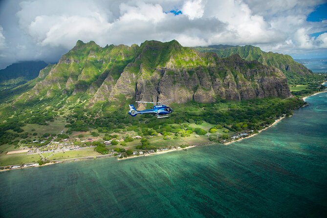
The flight continues over a private nature reserve and working cattle ranch covering more than 4,000 acres. The area is popular for visitors and movie filming, but from above its importance is the open space itself. You get a look at a side of Oahu that is neither beach resort nor city street.
The route also includes a waterfall about 1,100 feet high. The waterfall is kapu, or forbidden, and its setting can only be reached by air. This is one of the strongest reasons to take the helicopter rather than simply drive around the island. Some parts of Oahu remain inaccessible from the ground, and the aircraft gives you a respectful view without entering a restricted area.
Do not expect to hover for a long private photo session at every site. The flight has a full route to cover, and wind or cloud conditions can change what you see. The value here is access and perspective, not a stop-and-stay format.
North Shore surf and the western mountains
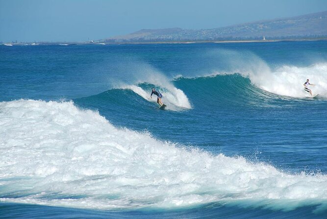
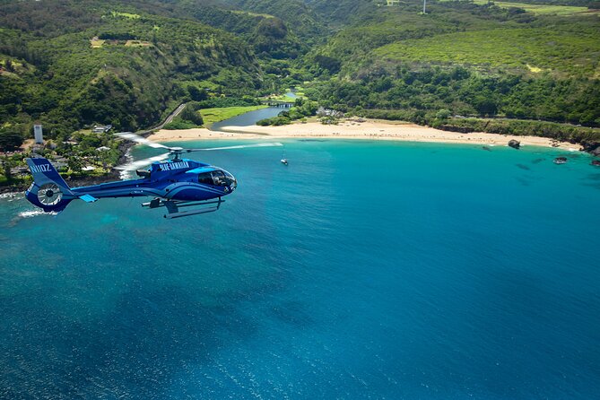
Oahu’s North Shore is known for its seven-mile stretch of surf coastline. Expansive reef formations create the conditions that made this part of the island famous. From above, the long coast shows its scale better than a single beach viewpoint can.
The North Shore is also a place where the aerial view may not match the postcard in every season or weather condition. The coast remains impressive, but surf size and water color vary. I would enjoy this section for its long sweep of reef and shore rather than expect one fixed spectacle.
On the western side, you see the eroded remains of an ancient shield volcano. That broad, worn form helps explain why Oahu has such different profiles from one coast to another. The island is not just a collection of beaches. Its ridges and valleys are the remains of major volcanic forces and long erosion.
The route also takes in the Nanakuli Forest Reserve and the coast from mauka to makai, meaning mountain to sea. Nanakuli Beach Park is a favorite local recreation spot, and this part of the flight gives you a look at West Oahu beyond the resort districts.
Ko Olina and the return to Honolulu
Ko Olina, sometimes called the Place of Joy, is a planned vacation and residential community on Oahu’s leeward coast. Its position on the drier side of the island contrasts with the wetter windward coast and the city concentration around Waikiki.
The view is useful because it rounds out the island’s character. You see resort development, open ridges, beaches, and the dry western shore in the same trip. By the time the helicopter returns to the heliport, you have covered an unusually wide range of Oahu’s geography.
What the $522.50 price really buys
At $522.50 per person, this is a premium activity. You are paying for the aircraft, pilot-guide, fuel and operating costs, safety equipment, taxes, and the chance to see remote sections of Oahu in about an hour. You are not paying for food, drinks, hotel transportation, or the optional in-flight photo and video packages.
The value depends on how you use your time. If you have only a few days on Oahu, the flight can show you places that would otherwise require several long drives. If you already plan to visit every coast by car, the helicopter still offers a view you cannot reproduce from the road, but the cost may feel harder to justify.
I would compare this price with your overall trip priorities. It makes more sense for a special occasion, a first visit, or anyone who places high value on aerial photography and island geography. It makes less sense if you dislike flying, have a tight budget, or prefer to spend a full day slowly exploring one district.
Optional video and photo packages are available after the flight, so bring a credit card if you want to consider one. You can also tip the pilot if you choose, since gratuity is not included.
Check-in, clothing, and flight-day rules
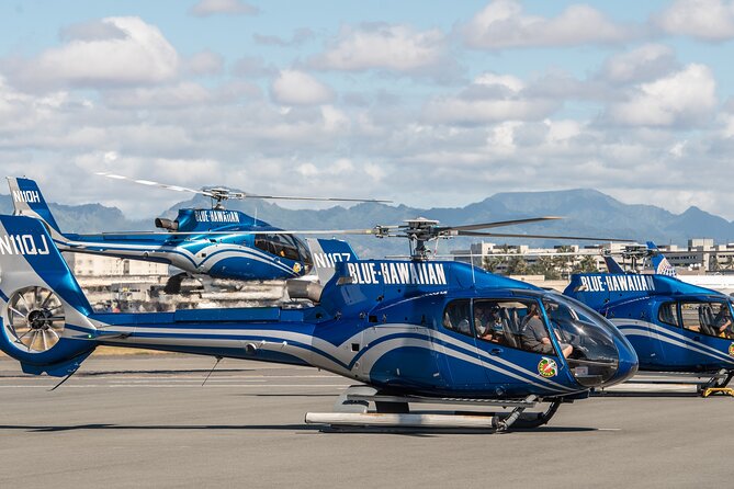
Plan to reach Blue Hawaiian Helicopters at 99 Kaulele Place in Honolulu 45 minutes before departure. That extra time covers passenger weighing, the safety briefing, and escorting you to the aircraft for an on-time departure. Traffic can be a problem, and late arrivals may not be accepted or refunded.
Passenger weight matters for aircraft balance. The listed limit is 240 pounds per passenger. If you weigh more than that, an adjacent empty seat is required, charged at half the regular tour price. Arrange that additional seat after booking.
Wear dark clothing. It reduces reflections in the windows and can make your photos cleaner. Hats, bags, large cameras, and extending selfie sticks are not permitted on the helicopter, so pack light for this outing.
Children 23 months and younger may ride free as lap children. Most people can participate, and the heliport is near public transportation. You should not scuba dive within 24 hours of departure.
The cancellation policy allows a full refund if you cancel at least 24 hours before the start time. Changes or cancellations inside that window are not accepted for a refund. Weather can cancel the flight, in which case you are offered another date or a full refund. The same choice applies if the minimum number of participants is not reached.
The pilots and the feel of the flight
The pilot is also your State of Hawaiʻi certified tour guide, so the narration is a key part of the experience. Pilots named in passenger feedback included Mark, Koji, and Benjamin, each praised for clear commentary, a friendly manner, and making the route easy to follow.
That personal narration matters on a flight with so many landmarks. A beach, reef, memorial, or ridge can pass quickly if nobody tells you where to look. The two-way microphone system also gives you a way to ask questions during the flight.
The strongest pattern in the feedback is simple: passengers valued the sense of safety, the full-island route, and the pilot commentary. One person had a rough start when poor visibility required rescheduling, but the company’s handling of the change restored confidence. That is a useful reminder that weather is part of the deal, not a minor footnote.
Should you book the Complete Island Oahu Helicopter Tour?
I would book this if you want a single high-impact view of Oahu, especially if this is your first visit or your schedule does not allow separate trips to Pearl Harbor, Kailua, the North Shore, and West Oahu. The six-person limit, clear headset system, and certified pilot-guide make the flight feel focused rather than rushed in a large group.
I would skip it if $522.50 would force you to cut better-fitting activities from your trip. You should also avoid placing it on the final day if possible, since weather may require a new time. For the right budget and the right expectations, this is one of the fastest ways to understand how Oahu’s city, beaches, volcanoes, ranch country, and remote valleys fit together.
FAQ
How long is the Complete Island Oahu Helicopter Tour?
The flight lasts approximately 1 hour and 5 minutes.
Where does the helicopter tour start and end?
It starts and ends at Blue Hawaiian Helicopters, 99 Kaulele Place, Honolulu, Hawaii 96819.
How early should I arrive?
You should check in 45 minutes before your scheduled tour time for the weight check, safety briefing, and aircraft seating.
How many people can join the tour?
The helicopter tour has a maximum of six travelers.
What happens if bad weather cancels the flight?
You will be offered a different date or a full refund if the tour is canceled because of poor weather.
Is transportation, food, or an in-flight photo package included?
Transportation to and from the heliport, food, drinks, and optional USB photo or video packages are not included.
Newly added flights around Oahu
- Oahu: Waikiki 20-Minute Doors On / Doors Off Helicopter Tour★ 4.9 · 32 reviews
- Oahu to Big Island : Big Island Volcano Helicopter Tour & Hilo 1 Day Tour★ 4.0 · 10 reviews
- Day Trip fr Oahu to Kauai: Highlights & Movie Sites w/ Helicopter★ 4.0 · 10 reviews
- 30 Minutes PRIVATE Helicopter Tour in Honolulu★ 5.0 · 26 reviews
- 60 Minutes SHARED Helicopter Tour in Honolulu★ 5.0 · 46 reviews
- Blue Skies of Oahu Helicopter Tour★ 5.0 · 50 reviews
- 18 Minutes SHARED Helicopter Tour in Honolulu★ 5.0 · 34 reviews
- 30 Minutes SHARED Helicopter Tour in Honolulu★ 5.0 · 27 reviews
Oahu Helicopter Tours, compared.

Oahu: Magnum PI Hughes 500 4-Passenger Doors-Off Helicopters
Read our review →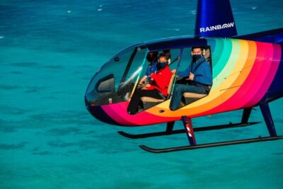
Private Oʻahu Helicopter Experience: All Window Seats
Read our review →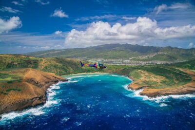
Oahu: Path to Pali 30-Minute Doors On or Off Helicopter Tour
Read our review →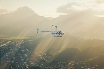

Browse the lists this tour appears in