
Review · SEDONA HELICOPTER TOURS
Secret Wilderness (45+ Mile) – Sedona Helicopter Tour
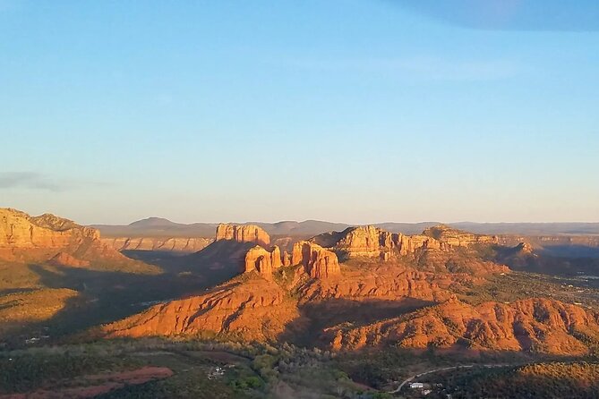
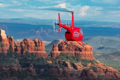
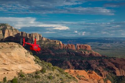
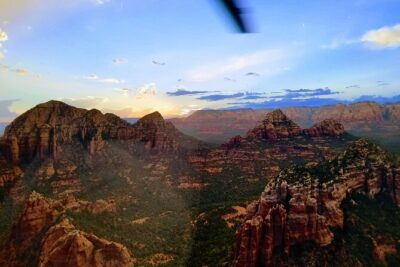
Sedona’s red rocks look impressive from the ground, but this 45-mile helicopter route shows how the cliffs, mesas, canyons, and landmarks fit together. You fly from Sedona Airport toward Cathedral Rock, Bell Rock, Oak Creek Canyon, and the more remote Secret Canyon area, with views that hiking trails simply cannot provide.
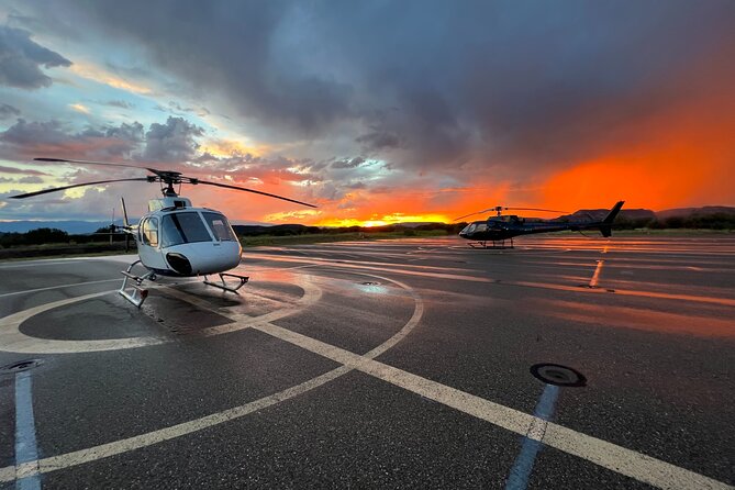
I like the small aircraft setting, with all forward-facing seats and a noise-reducing headset. I also like the personal guiding style. Joshua, Steve, and other Apex pilots have been praised for clear safety briefings, local knowledge, and a few well-timed laughs. The main consideration is price: at $438.30 per person, this is a special-occasion splurge, not a casual sightseeing ride.
Key points to know
- Secret Canyon reaches remote country that requires extensive hiking to see from the ground.
- Cathedral Rock looks completely different from the air, especially when the helicopter flies level with its upper rim.
- Ancient Sinagua cliff dwellings can be seen along Boynton and Long Canyons.
- All seats face forward, and noise-reducing headsets help you hear the pilot’s commentary.
- The flight covers about 45 miles in 30 to 32 minutes, so expect a brisk tour with little wasted time.
- Weather matters, and poor conditions can lead to a free rescheduling or refund.
Why this Sedona flight covers more than the usual red-rock sights
Many Sedona outings focus on one trail, one jeep route, or one scenic road. This flight packs a wide sweep of the area into roughly half an hour. From the airport, you head over familiar formations such as Thunder Mountain and Coffee Pot Rock, then continue toward major hiking areas and remote canyons.
That range is the real value. You are not only looking at famous formations from above. You are seeing how Oak Creek Canyon connects with the rock country, how Cathedral Rock rises beside nearby landmarks, and how isolated Secret Canyon feels compared with the busy trail areas.
The route is also useful if your time in Sedona is short. You will not hike the trails or stop at the formations, but you can understand the region’s layout quickly. I would especially consider it at the beginning of a longer visit, when an aerial view helps you decide which places deserve time on foot.
A few more flights around the USA worth comparing
- New York City: Manhattan Helicopter Tour
★ 4.7 · 7,076 reviews - NYC: Manhattan Sightseeing Helicopter Tour
★ 4.8 · 5,826 reviews - Las Vegas Helicopter Night Strip Flight Tour with Optional Dinner
★ 4.5 · 5,693 reviews
Taking off from Sedona Airport with a clear view
The meeting point is at 1225 Airport Road, Sedona, and the flight begins and ends there. The airport setting gives you an immediate overlook of the surrounding red rocks as the helicopter takes off and later returns.
The opening views include Thunder Mountain, Coffee Pot Rock, Ship Rock, The Mitten, and The Sphinx. These names can blur together on a map, but the aerial angle helps you sort them out. From above, their shapes and positions become easier to remember.
A noise-reducing headset with a microphone is included. That matters in a helicopter, where ordinary conversation can be difficult. The live commentary is one of the better features of this experience. Joshua has been noted for a careful safety briefing and strong knowledge of the area, while Steve has been praised for smooth flying and useful narration.
The flight uses forward-facing seats, which is a practical advantage for photography and sightseeing. Still, remember that this is a moving aircraft, not a private viewing platform. You get broad sightlines, but the scenery passes quickly.
Red Rock State Park and Cathedral Rock from the air
The route continues past Red Rock State Park, with views of Oak Creek, Schuerman Mountain, and Pyramid Rock. From ground level, you often see one formation at a time. From the helicopter, you can take in the wider relationship between the creek and the high red-rock walls.
The highlight for many people will be Cathedral Rock at eye level. The helicopter passes close enough to show the top of the formation from a perspective unavailable on the trail. As the aircraft rounds Cathedral Rock, the Chapel of the Holy Cross and the Praying Hands come into view.
The Chapel is one of Sedona’s best-known buildings, set into the red rocks. Seeing it from the air gives you a better sense of its position than a roadside stop does. The Praying Hands add another distinctive shape to the view.
This section is particularly strong for anyone who has already hiked around Cathedral Rock. You recognize the formation, then see its upper contours and surrounding cliffs in a new way. If you have not visited before, the aerial view gives you a useful preview, though it cannot replace walking among the rocks.
Bell Rock, Broken Arrow, and Courthouse Butte
Bell Rock is one of the area’s most popular hiking spots, and from the helicopter you see its full profile rather than the partial views available from nearby roads. The aircraft then passes over the Broken Arrow Trail, including the Praying Hands, Chicken Point, and Submarine Rock.
These names represent a concentrated stretch of classic Sedona scenery. Chicken Point is especially familiar to people who have explored the Broken Arrow area, while Submarine Rock has a more isolated shape that reads clearly from above.
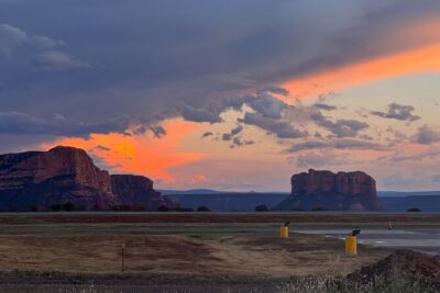
Courthouse Butte follows. At more than 1,000 feet tall, it is an imposing formation and a draw for climbers and base jumpers. From the air, you can appreciate its height without having to judge it from a trail below.
The route also passes Snoopy Rock, the Tea Kettle, Eagle Rock, and the Cowpies. Some of these formations are easier to recognize than others, so the pilot’s narration adds real value. Without live guidance, a quick flight can become a blur of red stone and similar-sounding names.
Same view, a different flight:
- Grand Canyon Village: Helicopter Tour & Hummer Tour Options
★ 4.7 · 2,586 reviews - Grand Canyon Deluxe Helicopter Tour with Landing from Las Vegas
★ 5.0 · 2,535 reviews - Kauai Eco Adventure Helicopter Tour
★ 5.0 · 2,032 reviews - 45-minute Helicopter Flight Over the Grand Canyon from Tusayan, Arizona
★ 5.0 · 1,959 reviews
Oak Creek Canyon and the northern red-rock country
The helicopter next passes Grasshopper Point, a popular swimming area, and Midgely Bridge. The bridge is a notable arch and landmark, but from the air you also gain a wider look at the terrain around it.
Wilson Mountain brings a change in scale. It is one of the area’s hardest hikes, and the flight provides views of Steamboat Rock, Ship Rock, and Oak Creek Canyon nearby. You can see how the canyon narrows and how the high ground frames Oak Creek.
The route reaches the mouth of Oak Creek Canyon, where the spring-fed creek runs year-round. This is one of the places where an aerial trip explains the geography better than a quick roadside viewpoint. You can follow the canyon’s opening and see the rock pillars and seasonal waterfalls farther along.
The helicopter also passes the Fin and Ship Rock. These formations can be difficult to place from the ground, but the bird’s-eye view brings them into one broad picture. If you like maps, geology, or simply understanding how a destination fits together, this part of the route is worth your attention.
Devil’s Bridge, Seven Canyons, and familiar trail country
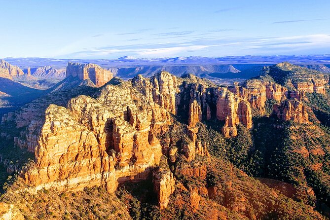
The flight includes Devil’s Bridge, one of Sedona’s most popular hikes. From above, you see the natural bridge as a formation within the wider red-rock setting. The aerial view cannot show the effort of reaching it on foot, but it does make clear how small the bridge is compared with the surrounding cliffs.
You also pass the Thunder Mountain Trailhead, with views toward Coffee Pot Rock, Soldiers Pass, The Mitten, and Sphinx Rock. This gives you a second look at some formations seen earlier, now from a different angle.
Seven Canyons golf course appears along the route as well. It is a brief part of the flight, but it helps mark the transition between developed areas and the more remote country ahead.
Because the tour moves at a steady pace, I would not expect long pauses over each landmark. If one formation matters most to you, tell the pilot or ask about it before takeoff. The route is broad rather than slow and deeply focused on one site.
Secret Canyon and the most remote part of the trip
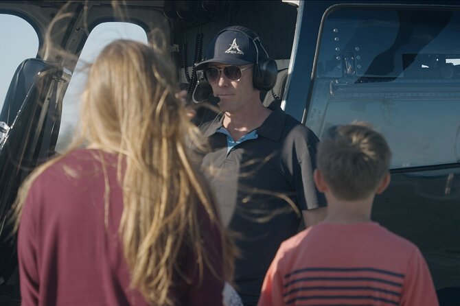
The namesake section takes you through Secret Canyon and past Secret Mountain. This is the strongest reason to choose the longer wilderness route rather than a short city flight. The area is reachable only by extensive hiking, so the helicopter gives you access to views that would otherwise require a serious outing.
The flight also passes over Bear Sign Canyon, described as one of the best panoramic sections of the route. Here, the appeal is not a single famous formation. It is the feeling of seeing a broad, quiet area with few signs of development.
The aircraft makes it possible to cover this country without spending most of a day on the trail. That convenience comes with a tradeoff: you see the wilderness from above, but you do not walk through it, stop for a picnic, or study the rocks at ground level.
This is also where weather and visibility matter most. Clear conditions should make the distant formations easier to distinguish. If poor weather cancels the flight, Apex Air Tours offers another date or a full refund, according to the stated policy.
Boynton and Long Canyons, with Sinagua cliff dwellings
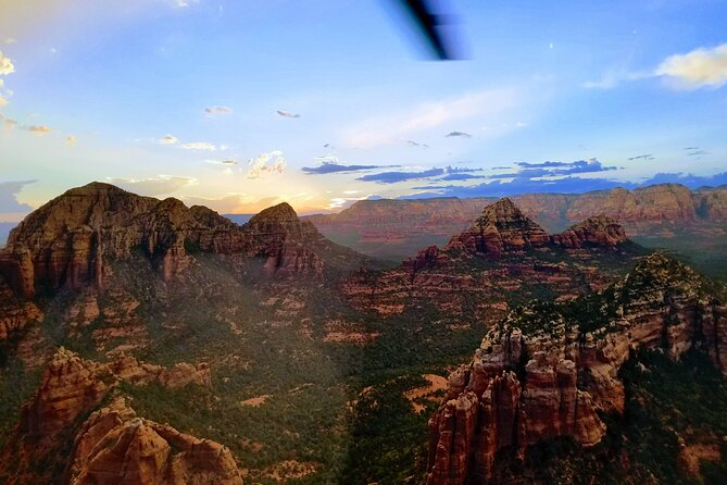
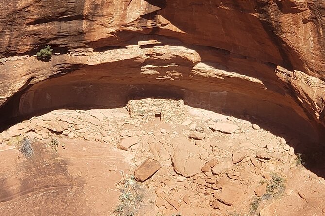
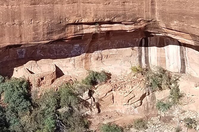
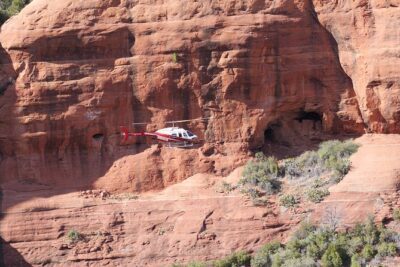
The route moves into Boynton Canyon, one of Sedona’s most striking canyons. Along the cliffs, you can see Sinagua dwellings. These remains are an important part of the area’s past, and viewing them from above helps show how naturally they fit into the canyon walls.
Long Canyon lies beside Boynton Canyon and continues the same pattern of tall walls, narrow passages, and cliff dwellings. The helicopter’s height lets you see farther into the canyon than many ground viewpoints allow.
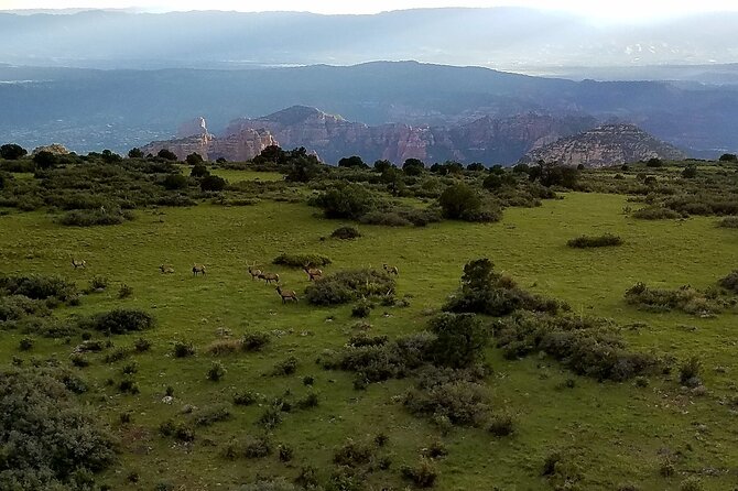
The pilot’s narration is especially important here. Ancient structures can be hard to spot, and a live guide can point them out before the aircraft moves on. The personal style has been a repeated strength of this operation. One flight with Joshua included sightings of elk on a ridge, while another pilot was praised for explaining the formations rather than relying on a recording.
Do keep expectations realistic. You may see the dwellings, but the flight does not include a ground visit, archaeological interpretation at a site, or time to explore a canyon on foot.
Mescal Mesa, Doe Mountain, and the return over Sedona
Mescal Mesa comes next, with the Birthing Cave along one side. The mesa is a popular hiking area, and from above you can understand its broad shape and position better than you can from the trailhead.
Doe Mountain is another strong aerial viewpoint. Hikers climb it for a wide panorama of Sedona’s red rocks, while the helicopter gives you that panorama without the climb. The route then passes Lower Chimney Rock Trail, where Chimney Rock changes into the three fingers as your viewing angle shifts.
That change in shape is a good reminder that formations are not fixed pictures. A rock that looks familiar from one road may seem entirely different from the air or from the opposite side.
On the way back, the helicopter passes Schuerman Mountain and opens into a final broad view of Sedona. Cathedral Rock, Bell Rock, Schnebly Hill, Ship Rock, Coffee Pot Rock, and Thunder Mountain can all appear in one sweeping scene.
This final section ties the flight together. You have seen individual formations close up, then get one last chance to understand the whole area as connected rock country.
What $438.30 buys you
At $438.30 per person, this is expensive compared with a self-guided drive or a day on the trails. The price makes more sense if you value access to remote country, a small aircraft, personal narration, and the ability to cover 45 miles in half an hour.
The flight is also a useful choice for a special occasion. It can make sense for a first visit when you want a quick overview, or for a return visit when you have already done the main hikes and want a different viewpoint.
The value is weaker if you dislike aircraft, prefer slow photography stops, or want to touch and walk among the formations. You should also consider the short duration. Thirty to 32 minutes sounds substantial, but the route is packed with landmarks, so the experience moves fast.
A five-person group size is highlighted, while the additional tour information lists a maximum of six travelers. The aircraft is therefore designed for a small group rather than a large sightseeing crowd. Confirm the exact passenger arrangement when booking if seat placement matters to you.
Who should book this helicopter tour?
I would recommend it most strongly to:
- First-time Sedona visitors who want a fast orientation
- Repeat visitors who have already explored the main trails
- Couples or families marking a special occasion
- Hikers curious about Secret Canyon, Boynton Canyon, or Long Canyon
- Anyone interested in seeing Sinagua cliff dwellings from a rare angle
- Visitors with limited time who still want a broad view of the region
It may be less suitable if you are uncomfortable in helicopters, need a slow and quiet sightseeing pace, or are hoping for a hiking experience. The tour requires good weather, and you should not fly if you are sick.
The stated passenger weight limit is 400 pounds per passenger. Confirmation is provided at booking, and most people can participate, but any special concern should be raised before the flight.
You can cancel for a full refund up to 24 hours before the start time. Cancellations or changes inside 24 hours are not refunded or accepted. If weather or the minimum number of passengers causes cancellation, you can choose another date or receive a full refund.
Should you book the Secret Wilderness flight?
Book it if you want maximum scenery in minimum time, especially if Secret Canyon and the cliff dwellings appeal to you. The combination of forward-facing seats, headsets, live commentary, and a route that reaches remote canyons gives this flight more substance than a quick pass over central Sedona.
The $438.30 cost is the real hurdle. I would not book it as a substitute for hiking, but I would consider it a strong splurge for a first visit, a return visit with limited time, or a memorable family outing. Look for clear weather, keep your expectations focused on views rather than stops, and choose this tour for the wide aerial picture that Sedona’s roads and trails cannot provide.
FAQ
Where does the Secret Wilderness helicopter tour begin?
The tour begins at 1225 Airport Road, Sedona, Arizona, and returns to the same meeting point.
How long is the helicopter flight?
The flight lasts approximately 30 to 32 minutes.
How far does the route travel?
The tour covers about 45 miles over Sedona and the surrounding wilderness areas.
What landmarks can I see from the helicopter?
The route includes Cathedral Rock, Bell Rock, Courthouse Butte, Devil’s Bridge, Oak Creek Canyon, Secret Canyon, Boynton Canyon, Long Canyon, Thunder Mountain, Coffee Pot Rock, and many other formations.
Can I see ancient cliff dwellings?
Yes. The flight passes Sinagua cliff dwellings in Boynton Canyon and Long Canyon.
Are all seats forward-facing?
Yes. The tour includes all forward-facing seating.
Is a headset included?
Yes. A noise-reducing headset with a microphone is provided.
How many people can join the tour?
The experience is designed for a small group. The tour highlights a group capped at five, while the additional information lists a maximum of six travelers.
What happens if bad weather cancels the flight?
You can choose a different date or receive a full refund if poor weather causes cancellation.
What is the cancellation policy?
You can cancel at least 24 hours before the start time for a full refund. Cancellations or changes made less than 24 hours before the start time are not accepted, and the amount paid is not refunded.
Newly added flights around the USA
- Zion National Park and Canaan Cliffs: Helicopter Tour★ 4.7 · 22 reviews
- Zion National Park, Canaan Cliffs: Extended Helicopter Tour★ 4.5 · 4 reviews
- West Maui and Molokai Special 45-Minute Helicopter Tour★ 5.0 · 9 reviews
- Oahu: Waikiki 20-Minute Doors On / Doors Off Helicopter Tour★ 4.9 · 32 reviews
- Waikoloa: Big Island Spectacular Helicopter Tour★ 4.5 · 5 reviews
- Las Vegas: Valley of Fire Helicopter with Scenic Landing★ 5.0 · 2 reviews
- Greater Yellowstone Trifecta Aerial Tour | 1-Hour Scenic Flight★ 5.0 · 6 reviews
- Couple’s Private Hudson Valley Fall Foliage Helicopter Tour from Westchester★ 4.5 · 3 reviews
Sedona Helicopter Tours, compared.
Everything Sedona (20+ Mile) – Sedona Helicopter Tour
Read our review →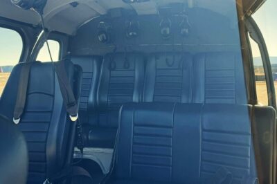
Ancient Sedona (30+ Mile) – Sedona Helicopter Tour
Read our review →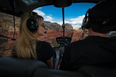
Mogollon Rim (80+ Mile) – Sedona Helicopter Tour
Read our review →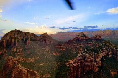
Browse the lists this tour appears in